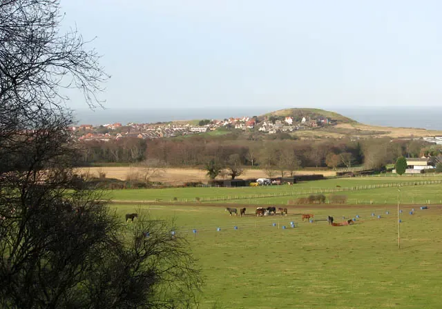
Beeston Regis and the Beeston Bump. Horses can be seen grazing the pastures in the foreground. This view was taken from the path which leads from Sandy Lane > 1085316 via the Roman Camp to the coastal village of Beeston Regis. Beeston Regis is located in an "Area of Outstanding Natural Beauty" which was formed by the retreating ice at the end of the ice age and sits within an area known as the "Cromer Ridge", consisting of wooded heath land > https://www.geograph.org.uk/photo/1085440 to the south (owned by the National Trust) and cliffs and beaches facing the North Sea. Part of these cliffs is a hill called "Beeston Bump" > https://www.geograph.org.uk/photo/1085582. Surrounded by the oaks and heather growing on Beeston Heath there is an enclosure named Roman Camp > https://www.geograph.org.uk/photo/1085482. It is adjoined by deep circular dips, called Hills and Holes, which are believed to date from prehistoric times > https://www.geograph.org.uk/photo/1085544. During Saxon-Norman and Roman times iron ore was dug here. Evidence of Roman habitation was found in 1859 when a complete set of quern stones (used for grinding grain) were discovered. The heath and woods > https://www.geograph.org.uk/photo/1085551 are a favourite site for bird watchers and many paths and bridleways, including the Norfolk Coastal Path, are leading through it. There are also several caravan and camping parks nearby. http://www.beestonregis.org/countryside.php
Author: Evelyn Simak, License: CC BY-SA 2.0
·
Source
Registration is currently only possible with an invite code. Please enter your invite code or use your personal invite link. If you don't have a code, you can request one from us.

 alpha
NOW FEDERATED!
alpha
NOW FEDERATED!