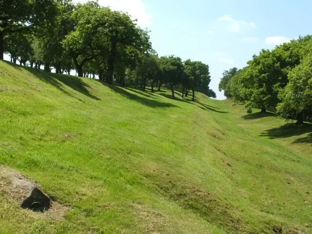
Antonine Wall at Seabegs Wood. Seabegs Wood was the site of a Roman fortlet (rather than a fort) along the Antonine Wall. At the time of writing, sixteen or seventeen forts were known along the course of the Wall, and eight or nine fortlets. This view is looking roughly westward. From left to right, it shows: the sloping northern side of the Wall itself; the ditch of the Wall; and the upcast mound of the ditch. Higher up at the same site is one of the best-preserved stretches of the Military Way, a Roman road which ran behind the Wall for its full length, and which was used in supplying forts and for moving troops: see 930390.
Author: Lairich Rig, License: CC BY-SA 2.0
· Source
Registration is currently only possible with an invite code. Please enter your invite code or use your personal invite link. If you don't have a code, you can request one from us.
 alpha
NOW FEDERATED!
alpha
NOW FEDERATED!