고조섬

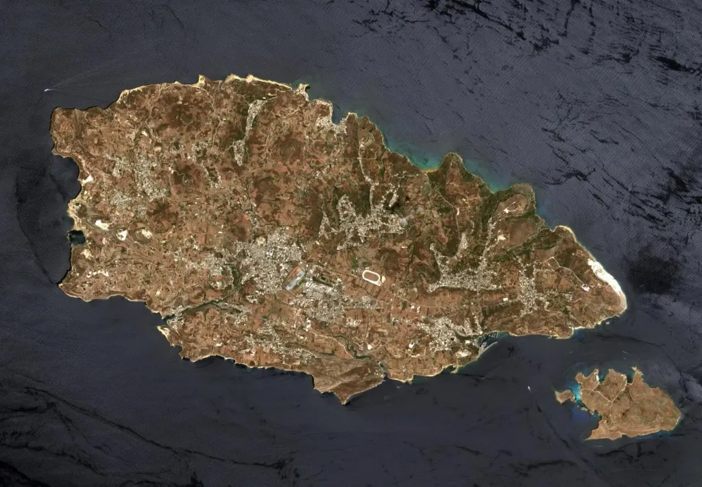
This image of Malta, captured by the Copernicus Sentinel-2B satellite is one of the first set of images delivered via Alphasat, which is in geostationary orbit 36 000 km above Earth. The image is a result of the two satellites using their optical communication instruments to transfer data via laser for fast delivery. This is essential for applications such as helping respond to disasters.
This image of Malta, captured by the Copernicus Sentinel-2B satellite is one of the first set of images delivered via Alphasat, which is in geostationary orbit 36 000 km above Earth. The image is a result of the two satellites using their optical communication instruments to transfer data via laser for fast delivery. This is essential for applications such as helping respond to disasters. Author: European Space Agency, License: CC BY-SA 3.0 igo · 출처

토론

이 장소에 대한 게시물이나 댓글이 아직 없습니다.